THOR: A foundation model for smarter climate action (FM4CS)
- Department Image analysis and Earth observation
- Fields involved Earth observation
- Industries involved Climate and environment
THOR is a foundation model for Earth observation (EO) set to replace today’s application specific artificial intelligence (AI) models for analysing EO data. By training a single, adaptable model on diverse satellite data, THOR enables faster, more scalable insights across a variety of environmental tasks, such as flood detection, drought- and sea ice monitoring. Faster, more efficient use of AI in environmental monitoring means quicker insights, earlier responses, and ultimately, more effective climate action.
THOR: A smarter way to monitor climate change
Today’s models for monitoring EO data are often fragmented and specialised.
Each task, whether it’s flood zone mapping or drought monitoring, typically requires a separate AI model, built from scratch, trained on specific datasets, and unable to share knowledge across domains. These systems are time-consuming, expensive, and require considerable expertise to manage.
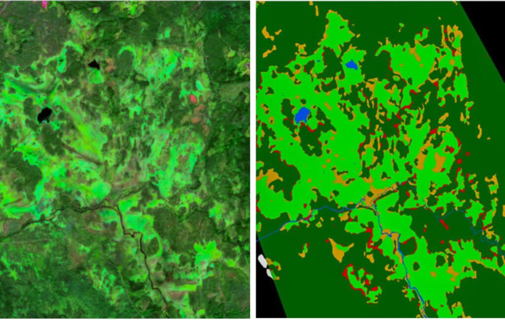
The FM4CS project introduces a new approach: THOR, a versatile foundation model that processes data from four different Sentinel sensors – Sentinel-1 SAR, Sentinel-2 MSI, Sentinel-3 OLCI, and Sentinel-3 SLSTR.
These sensors capture various imaging modalities, including radar, multispectral, and thermal images, with resolutions ranging from 10 m to 1000 m.
THOR’s adaptability accelerates the application of AI in climate monitoring and response, thereby supporting faster and more informed decision-making across science, policy, and society.
What is a foundation model for Earth observation?
A foundation model is a large-scale AI system trained om vast and varied datasets. A familiar example is ChatGpt, which learns from text. THOR, by contrast, is trained on data from four different sensors onboard Sentinel 1, 2 & 3 satellites, combining radar and multispectral imagery.
Unlike traditional task-specific models, which must be trained separately for each application, a foundation model can generalise across multiple monitoring tasks. Through self-supervised learning, this reduces the need for manually labelled datasets and can be fine-tuned quickly to handle various environmental challenges.
To learn more about THOR,
get in touch:
Project: Foundation Models for Climate and Society (FM4CS)
Partners: The Danish Meteorological Institute, the National Meteorological Administration of Romania, the Norwegian Water Resources and Energy Directorate (NVE), Polar View ApS, UiT Arctic University of Norway
Funding: The European Space Agency (ESA) – Φ-lab
Period: 2024 – 2025

Further reading
Foundation models for climate and society (FM4CS) – project page, ESA.
The rise of foundation models in image analysis – article, LinkedIn – 11.04.24.
Downstream applications include:
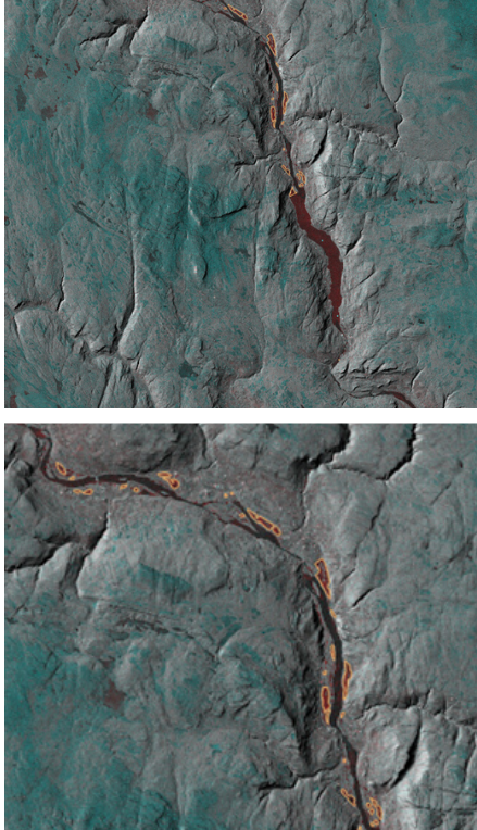
- Flood zone mapping
- Snow monitoring
- Drought monitoring and mapping
- Sea ice mapping
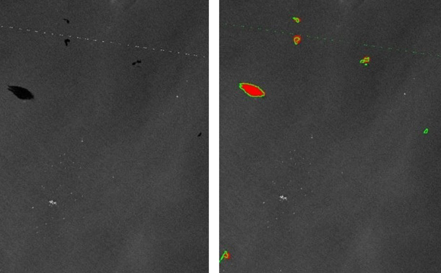
- Iceberg detection and monitoring
- Wetland mapping
- Oil spill detection
From isolated tools to integrated intelligence
Traditional EO models are siloed in both development and function, each designed for a specific task with no inherent capacity for sharing insights. Improving a flood model, for example, does nothing to enhance a model for drought detection. THOR changes this by learning general patterns in Earth’s surface and applying this knowledge across domains with minimal fine-tuning.
Because the model understands cross-domain dynamics, knowledge gained in one area may accelerate understanding in another. This form of synergy is critical for responding to a rapidly changing climate.
Replacing time-consuming, manual workflows
Many current climate monitoring models rely on outdated and incomplete satellite data, requiring time-intensive manual analysis. These workflows can take weeks or months, and are often too slow to inform urgent decisions.
By adapting to new satellite sources immediately, THOR offers a faster alternative. In addition, it enables transferable insights between tasks and supports near-real-time environmental services. Where traditional models may need months to adjust to a new satellite, THOR can begin learning right away.
A more equitable model for climate action
THOR presents measurable advantages across sectors. For scientists and AI professionals, it simplifies development pipelines, enabling faster iterations, lower training costs, and greater scalability. It also supports near-real-time monitoring systems.
For policymakers and emergency responders, access to more timely and consistent data supports earlier risk detection and proactive resource allocation. The model also enables standardised outputs, improving coordination efforts across national borders and aligning with broader climate action frameworks.
Smaller agencies and NGOs, which often lack the resources to build and maintain advanced AI tools, also stand to benefit. THOR reduces the technical and financial barriers to entry, making high-quality EO more accessible. This supports more equitable participation in global climate efforts and reduces the fragmentation seen in locally developed, siloed models.
Collaborating organisations
