Birch pollen prediction using satellite data (Sen4Pol)
- Department Image analysis and Earth observation
- Fields involved Earth observation, Climate and Environment, Mapping and map revision
Seasonal hay fever affects a significant proportion of the public every year. We have developed a mapping tool for predicted birch pollen release which is used by the Norwegian Asthma and Allergy Association in their daily pollen forecasts.
Typically, the pollen forecasts rely on data gathered at twelve measurement stations positioned across the country. However, a notable challenge arises due to the onset of the pollen season, which varies across regions and often changes from year to year.
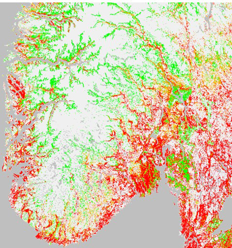
A map of predicted birch pollen release
NR has developed a pilot service which downloads daily satellite acquisitions of Norway, calculates the vegetation index, and compares it with observations from preceding years. This results in a daily map of predicted pollen release at 1 kilometre resolution, and enables prediction of the occurence, or absence, of foliage bounce on birch trees. The map delivers a more precise spatial distribution of predicted pollen release than the twelve measurement stations can provid, enabling The Norwegian Asthma and Allergy Association to provide accurate pollen forecasts to the Norwegian public.
To learn more about this project, please contact:

Project: Sen4Pol
Funding: The Norwegian Asthma and Allergy Association
Period: 2018 – 2021