Mapping our cultural heritage (CultSearcher)
- Department BAMJO
- Fields involved Earth observation, Mapping and map revision
- Industries involved Community, Climate and environment
We have developed methods for automated detection of cultural monuments and sites that are concealed by outfields and forestlands.
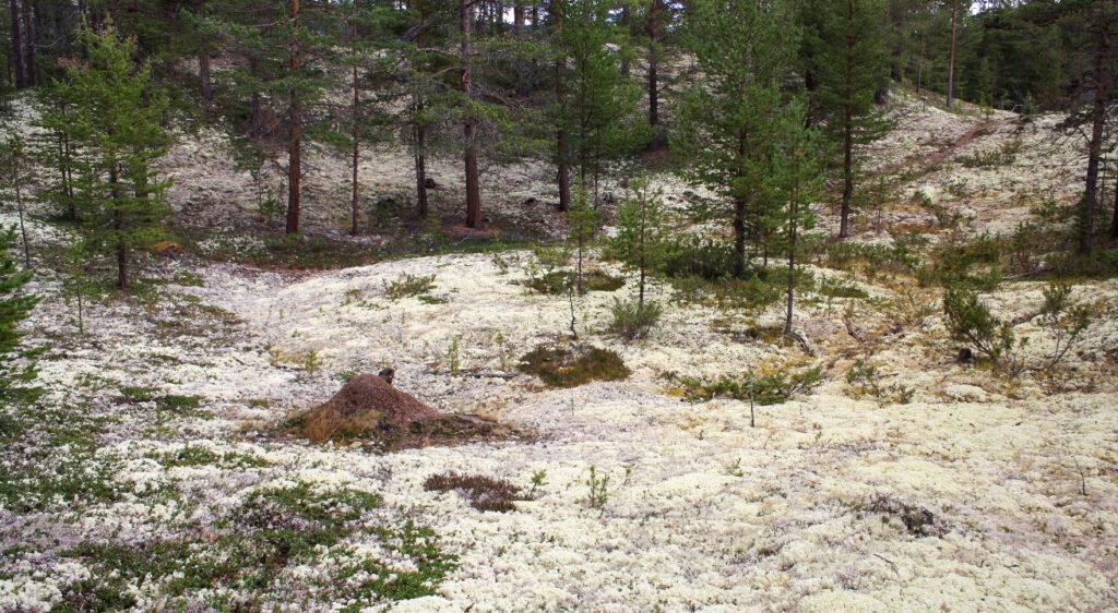
The current mapping of cultural heritage sites in forests and outfields is incomplete and inaccurate. This can lead to the potential loss or damage of valuable sites and monuments during development projects. In collaboration with the Directorate of Cultural Heritage in Norway and selected county administrations, we have developed automated detection methods to locate previously unmapped cultural heritage sites using laser scanning and deep learning. Airborne laser scanning enables us to assess ground levels, and makes it easier to detect sites of significance.
Deep learning for cultural heritage management
After testing a few different approaches with varying success, including template matching and a deep convolutional neural network (CNN), we landed on our current method, which leverages the power of Faster R-CNN. This deep neural network was pretrained on one million natural scene images that featured labelled objects such as vehicles, animals and people. This endowed the network with basic object detection capabilities which was then fine-tuned with laser scanning images that featured 3.000 known instances of various cultural heritage sites. Our advanced approach could then be used to accurately predict the locations of grave mounds, pitfall traps and charcoal kilns, even when they were not part of the training dataset.
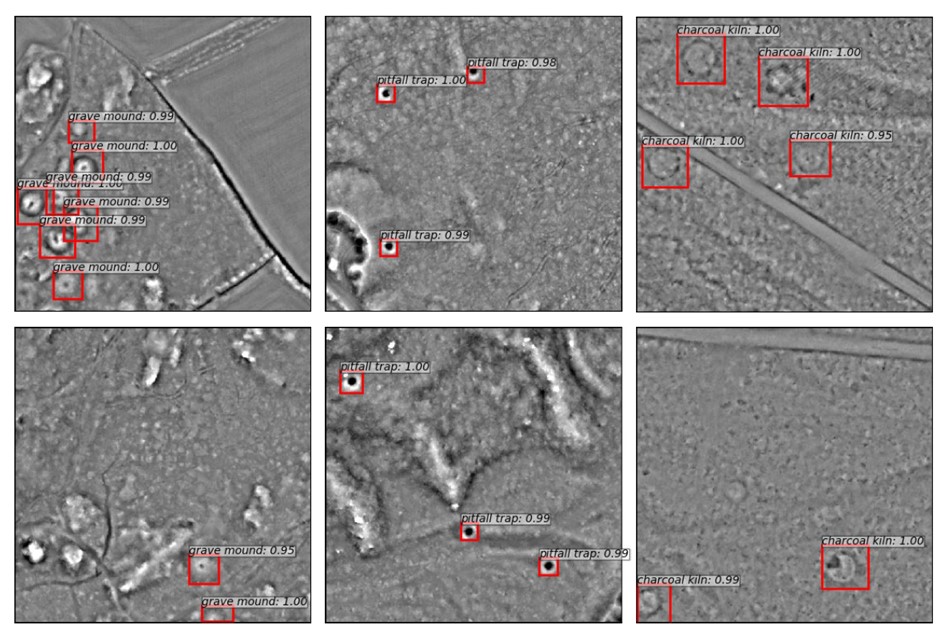
Mapping charcoal kilns, iron extraction sites and burial mounds
The true value of an automated prediction is to detect unknown locations. To test our method, we chose Øvre Eiker municipality which, at that point, only had about ten previously known charcoal kiln locations. Given its proximity to Kongberg’s silver mines, which used charcoal in the 1600s, we therefore suspected many more sites. Our method covered the entire municipality and predicted 1.130 locations. Upon manual inspection, 578 (51%) were confirmed, and we found an additional 66 charcoal kilns that the automated method had missed.
During the project period, we made several other notable discoveries. These included identifying iron extraction sites and pitfall traps for deer in Øystre Slidre, as well as detecting sixteen burial mounds in the country municipalities of Vestfold and Telemark.
To learn more about this project, please contact:
Project: CultSearcher
Partners: The Directorate for Cultural Heritage in Norway, The Norwegian Institute for Cultural Heritage (NIKU), The Museum of Cultural History, Vestfold county municipality, Innlandet county municipality (previously Oppland), Trøndelag county municipality (previously Sør-Trøndelag), Buskerud county municipality, Telemark county municipality
Period: 2003-2016
Publications:
Trier, Ø.D., Pilø, L.H., 2012. Automatic detection of pit structures in airborne laser scanning data. Archaeological Prospection 19 (2), 103–121. https://doi.org/10.1002/arp.1421.
Trier, Ø.D., Reksten, J.H., Løseth, K., 2021. Automated mapping of cultural heritage in Norway from airborne lidar data using faster R-CNN. International Journal of Applied Earth Observations and Geoinformation 95, paper No. 102241. https://doi.org/10.1016/j.jag.2020.102241.
Trier, Ø.D., Salberg, A.-B., Pilø, L.H., 2016. Semi-automatic mapping of charcoal kilns from airborne laser scanning data using deep learning. In: Proceedings of the 44th Conference on Computer Applications and Quantitative Methods in Archaeology, Oslo, Norway, 30 March-3 April 2016, pp. 219-231. Read the chapter via Google Books.