Senior Research Scientist
Øivind Due Trier
- Department Image analysis and Earth observation
- Phone number +47 22 85 26 98
- E-mail trier@nr.no
Projects
- Earth observation
- Climate and Environment
- Mapping and map revision
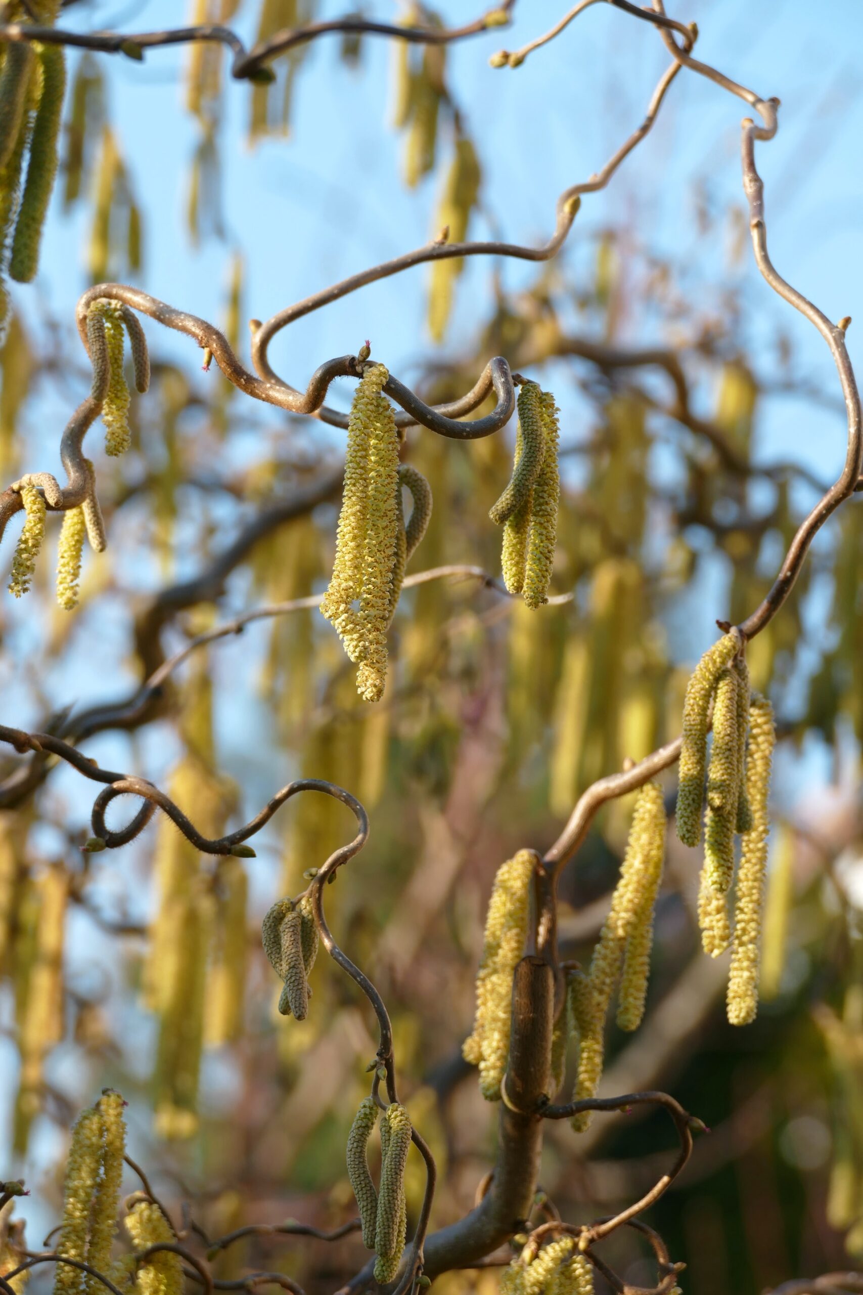
Birch pollen prediction using satellite data (Sen4Pol)
- Earth observation
- Mapping and map revision
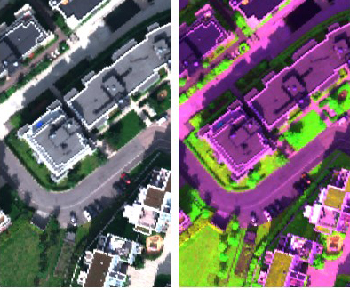
Automated mapping (AutoKart)
- Earth observation
- Mapping and map revision
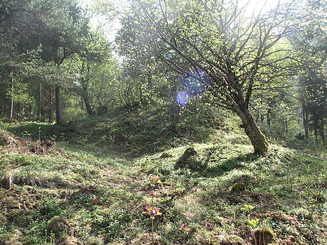
Mapping our cultural heritage (CultSearcher)
- Earth observation
- Climate and Environment
- Mapping and map revision
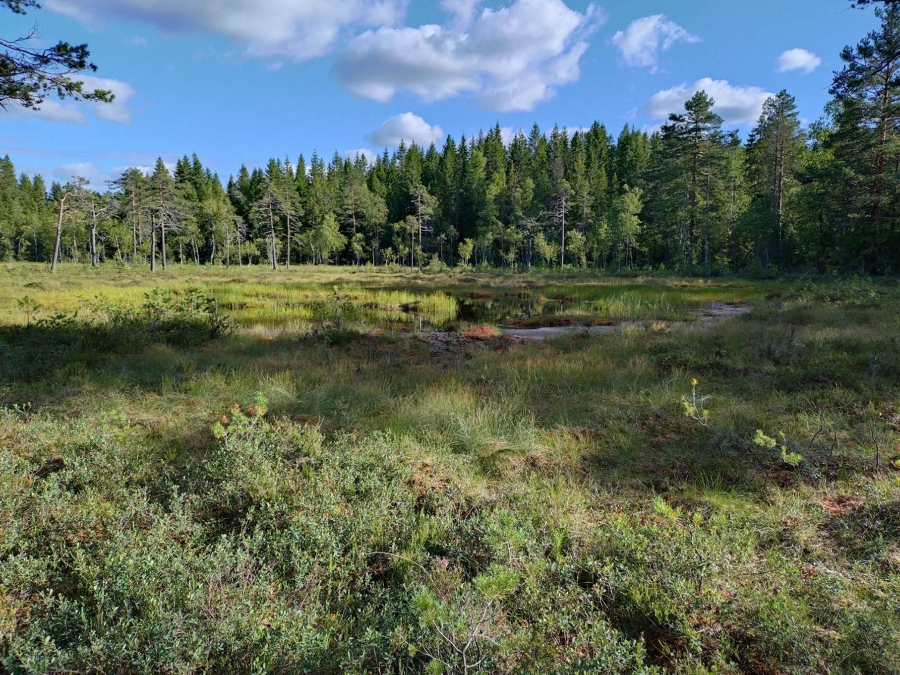
Using deep neural networks to map wetlands (LAVDAS)
Publications
- 200 publications found
- Publisher
Fredrik Andreas Dahl; Øivind Due Trier; Rune Solberg; Analyse av avvikskarakteristikk for snødekningsgrad , 2026. Report
DAVID COWLEY; Žiga Kokalj; Øivind Due Trier; Ole Risbøl; Guidelines for the use of Airborne Laser Scanning (Lidar) in Archaeology (EAC Guidelines 10) (ISSN 9789639911734 ), doi: https://doi.org/10.5281/ZENODO.14609210 , 2025. Non fiction book
Øivind Due Trier; LAVDAS kildekode , 2025. Report
Øivind Due Trier; Performance evaluation of deep learning methods for archaeological object detection in airborne lidar data 2024. Scientific lecture
Ingrid Aarnes; Ragnar Hauge; Øivind Due Trier; Ola Haug; Ariel Almendral Vazquez; Hierarkisk modell for naturtyper til bruk i naturregnskap NR-notat, 2024. Abstract
Øivind Due Trier; Arnt Børre Salberg; National-Scale Detection of New Forest Roads in Sentinel-2 Time Series Remote Sensing, vol. 16, (ISSN 2072-4292 ), doi: https://doi.org/10.3390/rs16213972 , 2024. Scientific article
Øivind Due Trier; Jarle Hamar Reksten; Rune Solberg; Validering og evaluering av FSC. Delprosjekt for snø og is i NVE Copernicus 2 2024. Report
Øivind Due Trier; Birch pollen predictions from Sentinel-2 images. Sen4Pol Phase 3 2024. Report
Øivind Due Trier; Horizon Europe possibilities for BAMJO 2024. Report
Øystein Rudjord; Anders U. Waldeland; Øivind Due Trier; Rune Solberg; Isdekningsgrad på innsjøer fra SLSTR med dyp læring 2024. Report
Ingrid Aarnes; Ragnar Hauge; Øivind Due Trier; Ola Haug; Ariel Almendral Vazquez; Hierarkisk modell for naturtyper til bruk i naturregnskap 2024. Report
Øivind Due Trier; Arnt-Børre Salberg; Bruk av kunstig intelligens / dyp læring på jordobservasjonsdata 2023. Lecture
Øivind Due Trier; Performance evaluation of deep learning methods for archaeological object detection in airborne lidar data 2023. Poster
Øivind Due Trier; Bidrag til sluttrapport. FKB maskinlæring 2023. Report
Øivind Due Trier; Driftspilot veideteksjon. Metodeforbedringer i 2022 2023. Report
Anders U. Waldeland; Øystein Rudjord; Øivind Due Trier; Rune Solberg; Videreutvikling av snødekningsgrad for SLSTR med dyp læring. Delprosjekt for snø og is i NVE Copernicus 2 2023. Report
Øivind Due Trier; Anders U. Waldeland; Rune Solberg; Videreutvikling av skydeteksjon for SLSTR med dyp læring. Delprosjekt for snø og is i NVE Copernicus 2 2023. Report
Rune Solberg; Øystein Rudjord; Øivind Due Trier; Harmonised snow variable retrieval for hydrological applications by reconstruction of the snow surface spectrum using radiative transfer modelling 2023. Scientific lecture
Øivind Due Trier; Arnt-Børre Salberg; Ragnvald Larsen; Ole Torbjørn Nyvoll; Detection of forest roads in Sentinel-2 images using U-Net 2022. Scientific lecture
Øivind Due Trier; Arnt Børre Salberg; Ragnvald Larsen; Ole Torbjørn Nyvoll; Detection of forest roads in Sentinel-2 images using U-Net Proceedings of the Northern Lights Deep Learning Workshop, vol. 3, (ISSN 2703-6928 ), doi: https://doi.org/10.7557/18.6246 , 2022. Scientific article
Anders Ueland Waldeland; Øivind Due Trier; Arnt-Børre Salberg; Forest mapping and monitoring in Africa using Sentinel-2 data and deep learning International Journal of Applied Earth Observation and Geoinformation, vol. 111, pp. 1 13 , (ISSN 1569-8432 1872-826X ), doi: https://doi.org/10.1016/j.jag.2022.102840 , 2022. Scientific article
Øivind Due Trier; Driftspilot naturinngrep. Metodeforbedringer i 2022 2022. Report
Øivind Due Trier; Jarle Hamar Reksten; Kristian Løseth; Automated mapping of cultural heritage in Norway from airborne lidar data using Faster R-CNN 2022. Scientific lecture
Øivind Due Trier; Jarle Hamar Reksten; Kristian Løseth; Automated mapping of cultural heritage in Norway from airborne laser scanning data using Faster R-CNN 2022. Scientific lecture
Øivind Due Trier; Arnt-Børre Salberg; Ragnvald Larsen; Ole Torbjørn Nyvoll; Detection of nature interventions in Sentinel-2 images of Norway using U-Net 2022. Scientific lecture
Rune Solberg; Øivind Due Trier; Sentinel for snow surface hoar mapping. Sentinel4SurfaceHoar project results 2022. Report
Øivind Due Trier; Jarle Hamar Reksten; Kristian Løseth; Automated mapping of cultural heritage in Norway from airborne lidar data using faster R-CNN International Journal of Applied Earth Observation and Geoinformation, vol. 95, pp. 1 19 , (ISSN 1569-8432 1872-826X ), doi: https://doi.org/10.1016/j.jag.2020.102241 , 2021. Scientific article
Maria Linea Horgen; Øivind Due Trier; Bygningsdeteksjon. Utprøving av to nevrale nettverk 2021. Report
Øivind Due Trier; Kristian Løseth; Detection of cultural heritage in airborne laser scanning data using Faster R-CNN. Results on Norwegian data pp. 227 238 , doi: https://doi.org/10.11588/propylaeum.747.c11786 , 2021. Scientific chapter / article / conference article
Øivind Due Trier; Towards automated urban map revision using deep neural networks on airborne lidar and hyperspectral data 2021. Lecture
Øivind Due Trier; Anders U. Waldeland; Rune Solberg; Automatisk skydeteksjon i Sentinel-3 SLSTR satellittbilder med U-Net. Første resultater 2021. Report
Øivind Due Trier; Arnt Børre Salberg; Driftspilot naturinngrep 2021. Report
Øivind Due Trier; Automated building detection with Mask R-CNN from combined hyperspectral and lidar data 2021. Scientific lecture
Øivind Due Trier; Bygningsdeteksjon i 8 cm flybilder 2021. Report
Rune Solberg; Jarle Hamar Reksten; Øivind Due Trier; Anders U. Waldeland; Nils Kristian Orthe; Utvikling av operasjonell snøtjeneste ved NVE. Resultater fra prosjektfase 3 2021. Report
Rune Solberg; Arnt Børre Salberg; Anders U. Waldeland; Jarle Hamar Reksten; Øivind Due Trier; Andreas Stokholm; Final report. AI4Arctic Deliverable 6 2021. Report
Øivind Due Trier; Presentasjon fra prosjektet om inngrepsfri natur og deteksjon av kulturminner 2021. Scientific lecture
Øivind Due Trier; Automated building detection from airborne hyperspectral and lidar data. 2021. Lecture
Erik Næsset; Eliakimu Zahabu; Øivind Due Trier; Terje Gobakken; Use of local and global maps of forest canopy height and aboveground biomass to enhance local estimates of biomass in miombo woodlands in Tanzania International Journal of Applied Earth Observation and Geoinformation, vol. 89, (ISSN 1569-8432 1872-826X ), doi: https://doi.org/10.1016/j.jag.2020.102109 , 2020. Scientific article
Øivind Due Trier; Arnt Børre Salberg; Kartlegging av naturinngrep. Sluttrapport 2020. Report
Øivind Due Trier; Deteksjon av skogsveger. Kartlegging av naturinngrep – fase 2 2020. Report
Øivind Due Trier; Automatisering av kartlegging. Status metodeutvikling, fase 1 i prosjektet 2020. Report
Øivind Due Trier; Kildekode for automatisert kartlegging. FKB maskinlæring 2020. Report
Jens Christian Wahl; Claudio Heinrich; Thordis Thorarinsdottir; Alba Ordonez; Øivind Due Trier; Arnt-Børre Salberg; Ola Haug; Stedsbasert risiko for vannskader - fase 1: Vurdering av topografiske indekser 2020. Report
Philipp Schneider; Paul David Hamer; Matthias Vogt; Øivind Due Trier; Rune Solberg; Hogne Skogesal; Trond Einar Brobakk; Hallvard Ramfjord; SEN4POL – Towards a Sentinel-based pollen information service 2020. Scientific lecture
Philipp Schneider; Paul David Hamer; Matthias Vogt; Øivind Due Trier; Rune Solberg; Hogne Skogesal; Trond Einar Brobakk; Hallvard Ramfjord; SEN4POL – Towards a Sentinel-based pollen information service 2020. Scientific lecture
Erik Næsset; Eliakimu Zahabu; Øivind Due Trier; Terje Gobakken; Corrigendum to ‘Use of local and global maps of forest canopy height and aboveground biomass to enhance local estimates of biomass in miombo woodlands in Tanzania’ [Int J Appl Earth Obs Geoinformation 89 (2020) 102109] International Journal of Applied Earth Observation and Geoinformation, vol. 93, (ISSN 1569-8432 1872-826X ), doi: https://doi.org/10.1016/j.jag.2020.102137 , 2020. Errata
Øivind Due Trier; Arnt-Børre Salberg; Deteksjon av veier i Sentinel-2 med U-Net. Fjernmåling av endringer i inngrepsfri natur. 2020. Scientific lecture
Øivind Due Trier; Arnt-Børre Salberg; Deteksjon av veier med Sentinel. Fjernmåling av endringer i inngrepsfri natur. 2020. Scientific lecture
Øystein Rudjord; Øivind Due Trier; Rune Solberg; Nick Hughes; Sentinel4ThinIce Phase 2 WP8: Diagnosis and correction of possible underestimated ice thickness. Sentinel4ThinIce project report 2020 2020. Report
Rune Solberg; Øystein Rudjord; Jarle Hamar Reksten; Øivind Due Trier; Multi-sensor multi-temporal FSC 2017-2020 dataset. S4S multi-FSC prototype products to EDI, Version 2.0. 2020. Report
David Gustavsson; Rune Solberg; Øivind Due Trier; Jarle Hamar Reksten; Øystein Rudjord; Dataset and data policy. AI4Arctic Deliverable 3. 2020. Report
Anders Ueland Waldeland; Arnt-Børre Salberg; Øivind Due Trier; Andreas Vollrath; Large-Scale Vegetation Height Mapping from Sentinel Data Using Deep Learning doi: https://doi.org/10.1109/IGARSS39084.2020.9323815 , 2020. Scientific chapter / article / conference article
Rune Solberg; Øivind Due Trier; Øystein Rudjord; Remote Sensing of Snow Properties with Sentinel-3 versus MODIS 2020. Scientific lecture
Erik Næsset; Eliakimu Zahabu; Øivind Due Trier; Terje Gobakken; Erratum: Use of local and global maps of forest canopy height and aboveground biomass to enhance local estimates of biomass in miombo woodlands in Tanzania (International Journal of Applied Earth Observations and Geoinformation (2020) 89, (S0303243419312103), (10.1016/j.jag.2020.102109)) International Journal of Applied Earth Observation and Geoinformation, vol. 93, (ISSN 1569-8432 1872-826X ), doi: https://doi.org/10.1016/j.jag.2020.102138 , 2020. Errata
Øivind Due Trier; Klassifikasjon og deteksjon ved bruk av kunstig intelligens 2019. Lecture
Rune Solberg; Øivind Due Trier; Mapping snow surface hoar by optical remote sensing 2019. Poster
Øystein Rudjord; Rune Solberg; Øivind Due Trier; Nick Hughes; Monitoring Thin Sea Ice Thickness with Sentinel-3 2019. Poster
Lars Holger Pilø; Øivind Due Trier; Arnt Børre Salberg; Kunstig intelligens finner skjulte kulturminner Aftenposten (morgenutg. : trykt utg.), pp. 24 25 , (ISSN 0804-3116 0807-2027 ), 2019. Science for the public article
Øivind Due Trier; Automated detection of grave mounds, deer hunting systems and charcoal burning platforms from airborne lidar data using faster-RCNN 2019. Scientific lecture
Øivind Due Trier; Detection of cultural heritage in airborne laser scanning data using Faster RCNN. Results on Norwegian data 2019. Scientific lecture
Øivind Due Trier; Automated mapping of cultural heritage in Norway from airborne lidar data using faster-RCNN 2019. Scientific lecture
Rune Solberg; Øivind Due Trier; Øystein Rudjord; Remote sensing of snow properties with Sentinel-3 2019. Scientific lecture
Øystein Rudjord; Rune Solberg; Jarle Hamar Reksten; Øivind Due Trier; Monitoring lake ice cover with Sentinel-3 2019. Scientific lecture
Øivind Due Trier; Arnt Børre Salberg; Kartlegging av naturinngrep. Foreløpig rapport 2019. Report
Øivind Due Trier; NGVEO project notes. Atmospheric correction of Sentinel-2 data 2019. Report
Rune Solberg; Jarle Hamar Reksten; Øivind Due Trier; Kjetil Melvold; Nils Kristian Orthe; Utvikling av operasjonell snøtjeneste ved NVE. Resultater fra prosjektfase 2. 2019. Report
Øivind Due Trier; Sen4Pol Phase 1. NDVI-based method for daily birch pollen prediction from Sentinel-3 2019. Report
Øivind Due Trier; CultSearcher user guide. Version 1.0 2019. Report
Øivind Due Trier; Jarle Hamar Reksten; Automated detection of cultural heritage in airborne lidar data. CultSearcher operationalisation 2019. Report
Philipp Schneider; Paul David Hamer; Øivind Due Trier; Rune Solberg; Hallvard Ramfjord; Trond Einar Brobakk; Hogne Skogesal; SEN4POL Phase-1: Final Scientific Report 2019. Report
Øystein Rudjord; Jarle Hamar Reksten; Rune Solberg; Øivind Due Trier; Kjetil Melvold; Utvikling av operasjonell innsjøistjeneste hos NVE: Resultater fra prosjektfase 2 2019. Report
Øystein Rudjord; Øivind Due Trier; Rune Solberg; Nick Hughes; Sentinel4ThinIce Phase 2. Thin ice thickness retrieval with Sentinel-3 2019. Report
Øivind Due Trier; Arnt Børre Salberg; Martin Andreas Kermit; Øystein Rudjord; Terje Gobakken; Erik Næsset; Dagrun Aarsten; Tree species classification in Norway from airborne hyperspectral and airborne laser scanning data European Journal of Remote Sensing, vol. 51, pp. 336 351 , (ISSN 2279-7254 ), doi: https://doi.org/10.1080/22797254.2018.1434424 , 2018. Scientific article
Øivind Due Trier; Arnt Børre Salberg; Jörg Haarpaintner; Dagrun Aarsten; Terje Gobakken; Erik Næsset; Multi-sensor forest vegetation height mapping methods for Tanzania European Journal of Remote Sensing, vol. 51, pp. 587 606 , (ISSN 2279-7254 ), doi: https://doi.org/10.1080/22797254.2018.1461533 , 2018. Scientific article
Øivind Due Trier; David C. Cowley; Anders U. Waldeland; Using deep neural networks on airborne laser scanning data: results from a case study of semi-automatic mapping of archaeological topography on Arran, Scotland Archaeological Prospection, vol. 26, pp. 165 175 , (ISSN 1075-2196 1099-0763 ), doi: https://doi.org/10.1002/arp.1731 , 2018. Scientific article
Øivind Due Trier; Arnt Børre Salberg; Lars Holger Pilø; Semi-automatic mapping of charcoal kilns from airborne laser scanning data using deep learning pp. 219 231 , 2018. Scientific chapter / article / conference article
Martin Andreas Kermit; Jarle Bauck Hamar; Øivind Due Trier; Towards a national infrastructure for semi-automatic mapping of cultural heritage in Norway pp. 159 172 , 2018. Scientific chapter / article / conference article
Øivind Due Trier; Anders Ueland Waldeland; David C. Cowley; Semi-automatic mapping of cultural heritage in Arran, Scotland, using deep neural networks on airborne laser scanning data 2018. Scientific lecture
Rune Solberg; Øivind Due Trier; Øystein Rudjord; Jarle Hamar Reksten; A portfolio of snow products based on Sentinel-3 for snow hydrology 2018. Scientific lecture
Arnt Børre Salberg; Anders U. Waldeland; Øivind Due Trier; Next Generation Value Chain for Earth Observation (NGVEO). Final report 2018. Report
Øivind Due Trier; eoTools user guide for processing of hyperspectral data 2018. Report
Øivind Due Trier; HyperBio final report 2018. Report
Øivind Due Trier; Anders U. Waldeland; David C. Cowley; Automating archaeological object detection. Proof of concept – Arran survey , 2018. Report
Rune Solberg; Sven-Erik Nilsen; Øivind Due Trier; Kjetil Melvold; Utvikling av operasjonell snøtjeneste hos NVE. Resultater fra prosjektfase 1. 2018. Report
Øystein Rudjord; Jarle Bauck Hamar; Rune Solberg; Øivind Due Trier; Kjetil Melvold; Utvikling av operasjonell innsjøistjeneste hos NVE. Resultater fra prosjektfase 1. 2018. Report
Anders U. Waldeland; Arnt Børre Salberg; Øivind Due Trier; Next Generation Value Chain for Earth Observation. Technical note: methodologies 2018. Report
Rune Solberg; Øystein Rudjord; Øivind Due Trier; Single- and multi-sensor snow-cover mapping from Sentinel-3 and Sentinel-1 2018. Report
Øystein Rudjord; Øivind Due Trier; Tree species classification with hyperspectral imaging and lidar Workshop on Hyperspectral Image and Signal Processing, Evolution in Remote Sensing, pp. 1 4 , (ISSN 2158-6276 ), doi: https://doi.org/10.1109/WHISPERS.2016.8071665 , 2017. Scientific article
Rune Solberg; Arnt Børre Salberg; Øivind Due Trier; Øystein Rudjord; Vasile Craciunescu; Remote sensing of snow wetness in Romania by Sentinel-1 and Terra MODIS data Romanian Journal of Physics, vol. 62, (ISSN 1221-146X ), , 2017. Scientific article
Arnt Børre Salberg; Øivind Due Trier; Michael C. Kampffmeyer; Large-Scale Mapping of Small Roads in Lidar Images Using Deep Convolutional Neural Networks pp. 193 204 , doi: https://doi.org/10.1007%2F978-3-319-59129-2_17 , 2017. Scientific chapter / article / conference article
Øivind Due Trier; Arnt Børre Salberg; Dagrun Aarsten; Forest tree species classification from airborne hyperspectral and laser scanning data using deep learning 2017. Scientific lecture
Øystein Rudjord; Rune Solberg; Øivind Due Trier; Arnt Børre Salberg; Vasile Craciunescu; Remote sensing of snow wetness using Sentinel: a multisensor approach 2017. Scientific lecture
Rune Solberg; Øystein Rudjord; Arnt Børre Salberg; Øivind Due Trier; Anisoara Irimescu; A multi-sensor multi-temporal approach to retrieving snow surface wetness from a combination of Sentinel-1 and Sentinel-3 data 2017. Scientific lecture
Claudiu Angearu; Rune Solberg; Arnt Børre Salberg; Øivind Due Trier; Multi-sensor wet snow product (MWS) from Sentinel-1 and Sentinel-3 vs multi-sensor wet snow product (MWS) from Sentinel-1 and MODIS 2017. Scientific lecture
Rune Solberg; Øivind Due Trier; Øystein Rudjord; Towards a portfolio of products for snow surface characterisation based on Sentinel-3 2017. Scientific lecture
Rune Solberg; Øystein Rudjord; Øivind Due Trier; Developing an approach for satellite observations of black carbon in snow surfaces in the Arctic 2017. Scientific lecture
Øystein Rudjord; Øivind Due Trier; Rune Solberg; Nick Hughes; Sentinel4ThinIce Phase 1: Algorithm improvements, validation and intercomparison 2017. Report
Rune Solberg; Arnt Børre Salberg; Jarle Hamar Reksten; Øivind Due Trier; Monica Sund; Eli Katrina Øydvin; Utvikling av operasjonell flomtjeneste ved NVE. Resultater fra prosjektfase nr. 1 2017. Report
Rune Solberg; Øystein Rudjord; Arnt Børre Salberg; Øivind Due Trier; Gheorghe Stancalie; Multi-sensor/multi-temporal prototype wet snow product – Version 2, SnowBall WP3, Deliverable D3.4 2017. Report
Rune Solberg; Arnt Børre Salberg; Jarle Hamar Reksten; Øivind Due Trier; Hervé Colleuille; Monica Sund; Utvikling av operasjonell flomtjeneste ved NVE, Resultater fra prosjektfase 2 2017. Report
Rune Solberg; Øystein Rudjord; Arnt Børre Salberg; Øivind Due Trier; Gheorghe Stancalie; Multi-sensor/multi-temporal prototype wet snow product – Version 3, SnowBall WP3, Deliverable D3.4, Sentinel-3 extension 2017. Report
Catalin Dumitrache; Rune Solberg; Øystein Rudjord; Øivind Due Trier; Current achievements towards developing downstream services for snow monitoring in Romania 2016. Lecture
Rune Solberg; Øystein Rudjord; Øivind Due Trier; Eirik Malnes; Heidi Hindberg; Multi-sensor fractional snow cover mapping by fusion of Sentinel-1 and Sentinel-3 data 2016. Poster
Rune Solberg; Arnt Børre Salberg; Øystein Rudjord; Øivind Due Trier; Anisoara Irimescu; Single and multi-sensor snow wetness mapping by Sentinel-1 and Sentinel-3 data 2016. Poster
Øivind Due Trier; Terje Gobakken; Arnt Børre Salberg; Dagrun Aarsten; Erik Næsset; Calculation of mean forest vegetation height in Tanzania from Landsat time series and airborne laser scanning data 2016. Poster
Øivind Due Trier; Martin Andreas Kermit; Øystein Rudjord; Terje Gobakken; Erik Næsset; Dagrun Aarsten; Tree species classification in Norway from airborne hyperspectral and airborne laser scanning data 2016. Poster
Øivind Due Trier; Arnt Børre Salberg; Lars Holger Pilø; Christer Tonning; Hans Marius Johansen; Dagrun Aarsten; Semi-automatic mapping of cultural heritage from airborne laser scanning using deep learning 2016. Scientific lecture
Rune Solberg; Øystein Rudjord; Arnt Børre Salberg; Øivind Due Trier; Anisoara Irimescu; Single and multi-sensor snow wetness mapping by Sentinel-1 and Sentinel-3 data 2016. Scientific lecture
Rune Solberg; Øystein Rudjord; Arnt Børre Salberg; Øivind Due Trier; Anisoara Irimescu; Single- and multi-sensor snow wetness mapping by Sentinel-1 and MODIS data 2016. Scientific lecture
Martin Andreas Kermit; Jarle Bauck Hamar; Øivind Due Trier; Towards a national infrastructure for semi-automatic mapping of cultural heritage in Norway 2016. Scientific lecture
Øivind Due Trier; Arnt Børre Salberg; Lars Holger Pilø; Semi-automatic detection of charcoal kilns from airborne laser scanning data 2016. Scientific lecture
Jarle Bauck Hamar; Arnt Børre Salberg; Øivind Due Trier; Oil spill detection using optical and thermal remote sensing data 2016. Report
Rune Solberg; Øystein Rudjord; Øivind Due Trier; Remote sensing of black carbon in the Arctic. BlackCarbon main project, Phase 1, Deliverables 1, 2 and 3 2016. Report
Øivind Due Trier; Arnt Børre Salberg; Jörg Haarpaintner; Dagrun Aarsten; Terje Gobakken; Erik Næsset; Automatic multi-sensor forest vegetation height mapping methods for Tanzania 2016. Report
Martin Andreas Kermit; Øivind Due Trier; Øystein Rudjord; Jarle Bauck Hamar; Dagrun Aarsten; Terje Gobakken; Erik Næsset; Tree species classification with airborne LiDAR and hyperspectral imaging. HyperBio Project Report 2016. 2016. Report
Øivind Due Trier; Evaluation of a new cloud masking method 2016. Report
Øivind Due Trier; Arnt Børre Salberg; Michael C. Kampffmeyer; Automatic mapping of forest roads 2016. Report
Øivind Due Trier; Jarle Bauck Hamar; Martin Andreas Kermit; Lars Holger Pilø; Arnt Børre Salberg; Application of remote sensing in cultural heritage management. CultSearcher project report 2015 , 2016. Report
Øivind Due Trier; Automatic mapping of forest density from airborne lidar data Geodezija ir Kartografija, vol. 41, pp. 49 65 , (ISSN 1392-1541 1648-3502 ), doi: https://doi.org/10.3846/20296991.2015.1051342 , 2015. Scientific article
Øivind Due Trier; Maciel Zortea; Christer Tonning; Automatic detection of mound structures in airborne laser scanning data Journal of Archaeological Science: Reports, vol. 2, pp. 69 79 , (ISSN 2352-409X 2352-4103 ), doi: https://doi.org/10.1016/j.jasrep.2015.01.005 , 2015. Scientific article
Øivind Due Trier; Lars Holger Pilø; Hans Marius Johansen; Semi-automatic mapping of cultural heritage from airborne laser scanning data Sémata, vol. 27, pp. 159 186 , (ISSN 2255-5978 ), , 2015. Scientific article
Øivind Due Trier; Lars Holger Pilø; Archaeological mapping of large forested areas, using semi-automatic detection and visual interpretation of high-resolution lidar data pp. 81 86 , 2015. Scientific chapter / article / conference article
Rune Solberg; Øivind Due Trier; Øystein Rudjord; Monitoring of snow properties with Sentinel-3 2015. Scientific lecture
Øivind Due Trier; Øystein Rudjord; Tree species classification with hyperspectral imaging and lidar. Some preliminary results 2015. Scientific lecture
Øivind Due Trier; Hans Marius Johansen; Steinar Kristensen; Lars Holger Pilø; Christer Tonning; Application of Remote Sensing in Cultural Heritage Management. Project report 2014 , 2015. Report
Øivind Due Trier; Utprøving av metoder for deteksjon av veier i laserdata – foreløpige resultater , 2015. Report
Øivind Due Trier; eoTools user guide for forest vegetation height estimation in Tanzania 2015. Report
Rune Solberg; Øystein Rudjord; Arnt Børre Salberg; Øivind Due Trier; Gheorghe Stăncălie; Multi-sensor/multi-temporal prototype wet snow product – Version 1 2015. Report
Rune Solberg; Arnt Børre Salberg; Øystein Rudjord; Øivind Due Trier; Gheorghe Stăncălie; Validated wet snow retrieval algorithms 2015. Report
Rune Solberg; Øivind Due Trier; Snow variable retrieval for snow avalanche risk assessment 2015. Report
David Gustafsson; Rune Solberg; Øivind Due Trier; Eirik Malnes; Preparation of European snow, glacier and lake/river ice services within the Copernicus CryoLand project 2014. Scientific lecture
David Gustafsson; Rune Solberg; Øivind Due Trier; Eirik Malnes; Evaluation and Quality assessment of GlobSnow-2 version 2 products 2014. Scientific lecture
Rune Solberg; Øivind Due Trier; A multi-parameter multi-temporal algorithm for inference of snow wetness from optical satellite data 2014. Scientific lecture
Øivind Due Trier; Hans Marius Johansen; Semi-automatisk deteksjon av gravhauger i lidardata. Detaljert kartlegging av vikinggravfeltet på Vang, Oppdal , 2014. Scientific lecture
Svein Solberg; Tor Peder Lohne; Jörg Haarpaintner; Miguel Kohling; Maciel Zortea; Øivind Due Trier; Monitoring deforestation and forest carbon stocks in Tanzania with satellite data 2014. Scientific lecture
Øivind Due Trier; Lars Holger Pilø; Archaeological mapping of large forested areas, using semi-automatic detection and visual interpretation of high-resolution lidar data 2014. Scientific lecture
Øystein Rudjord; Øivind Due Trier; Maciel Zortea; Rune Solberg; Nick Hughes; Sebastian Gerland; Angelika Renner; Thin ice thickness from MODIS: Improvement of algorithm and evaluation of product 2014. Report
Øivind Due Trier; Rune Solberg; Snow reference maps for SE product validation in mountain regions based on VHR data. Report on GlobSnow-2 Task 5.2.34 work 2014. Report
Øivind Due Trier; Steinar Kristensen; Anke Loska; Lars Holger Pilø; Magne Samdal; Christer Tonning; Maciel Zortea; Monica Kristiansen; Application of Remote Sensing in Cultural Heritage Management.Project report 2013 , 2014. Report
Maciel Zortea; Øivind Due Trier; Monitoring of changes in urban environments using satellite images 2014. Report
Maciel Zortea; Øivind Due Trier; Study of the spectral variability of the surface reflectance from Landsat in Liwale using LiDAR reference maps 2014. Report
Øivind Due Trier; Maciel Zortea; Christer Tonning; Anke Loska; Grave mounds discovered by automatic heap detection method pp. 305 329 , , 2013. Scientific chapter / article / conference article
Roberto Saldo; Øystein Rudjord; Øivind Due Trier; Rune Solberg; Natalia Ivanova; High resolving sea ice concentration, and thickness of thin sea ice 2013. Scientific lecture
Øivind Due Trier; High resolution snow validation maps 2013. Report
Rune Solberg; Øivind Due Trier; Determining bare-ground reflectance in mountain regions for fractional snow cover retrieval. Report on GlobSnow-2 Task 2.1.2 work 2013. Report
Øivind Due Trier; Rune Solberg; Time series of snow surface temperature and wetness observed with MODIS. Project report to Statkraft 2013. Report
Øivind Due Trier; Steinar Kristensen; Siri Øyen Larsen; Knut Harald Stomsvik; Christer Tonning; Maciel Zortea; Application of Remote Sensing in Cultural Heritage Management. Project report 2012 , 2013. Report
Øystein Rudjord; Øivind Due Trier; Rune Solberg; Improved model, algorithm and processing chain – deliverable D1 and D2 from the Thinice2 project 2013. Report
Arnt Børre Salberg; Øivind Due Trier; TEMPORAL ANALYSIS OF MULTISENSOR DATA FOR FOREST CHANGE DETECTION USING HIDDEN MARKOV MODELS IEEE Geoscience and Remote Sensing Letters, pp. 6749 6752 , (ISSN 1545-598X 1558-0571 ), 2012. Scientific article
Øivind Thorvald Due Trier; Lars Holger Pilø; Automatic detection of pit structures in airborne laser scanning data Archaeological Prospection, vol. 19, pp. 103 121 , (ISSN 1075-2196 1099-0763 ), doi: https://doi.org/10.1002/arp.1421 , 2012. Scientific article
Øystein Rudjord; Øivind Due Trier; Rune Solberg; Automatic estimation of lake ice cover and lake surface temperature using ENVISAT MERIS and AATSR Geophysical Research Abstracts, vol. 14, pp. 5306 5306 , (ISSN 1029-7006 1607-7962 ), , 2012. Abstract
Øivind Due Trier; Maciel Zortea; Siri Øyen Larsen; Semi-automatic detection of burial mounds in forested areas pp. 113 124 , , 2012. Scientific chapter / article / conference article
Siri Øyen Larsen; Arnt Børre Salberg; Øivind Due Trier; Operational Traffic Monitoring Using Very High Resolution Satellite Imagery pp. 608 617 , doi: https://doi.org/10.1080/01431161.2013.782708 , 2012. Scientific chapter / article / conference article
Arnt Børre Salberg; Øivind Due Trier; TEMPORAL ANALYSIS OF MULTISENSOR DATA FOR FOREST CHANGE DETECTION USING HIDDEN MARKOV MODELS pp. 6749 6752 , doi: https://doi.org/10.1109/igarss.2012.6352556 , 2012. Scientific chapter / article / conference article
Øivind Due Trier; Maciel Zortea; Semi-automatic detection of cultural heritage in lidar data pp. 123 128 , , 2012. Scientific chapter / article / conference article
Maciel Zortea; Arnt Børre Salberg; Øivind Due Trier; Object-based cloud and cloud shadow detection in Landsat images for tropical forest monitoring pp. 326 331 , , 2012. Scientific chapter / article / conference article
Jörg Haarpaintner; Øivind Due Trier; Jared Otieno; GEO FCT Product Development Team report, Tanzania 2012. Scientific lecture
Øystein Rudjord; Øivind Due Trier; Rune Solberg; Automatic estimation of seasonal sea ice thickness with MODIS data 2012. Scientific lecture
Øystein Rudjord; Øivind Due Trier; Rune Solberg; Automatic estimation of lake ice cover and lake surface temperature using ENVISAT MERIS and AATSR 2012. Scientific lecture
Maciel Zortea; Øivind Due Trier; Arnt Børre Salberg; Cloud and cloud shadow detection in Landsat images for monitoring tropical forests in Tanzania 2012. Report
Øystein Rudjord; Øivind Due Trier; Evaluation of FLAASH atmospheric correction , 2012. Report
Øivind Thorvald Due Trier; Lars Gustavsen; Lars Holger Pilø; Christer Tonning; Application of remote sensing in cultural heritage management – Project report 2011 , 2012. Report
Øivind Due Trier; Cato Guhnfeldt; Datamaskin fant 16 gravhauger , 2012. Media interview
Arnt Børre Salberg; Øivind Thorvald Due Trier; Temporal analysis of forest cover using hidden Markov models pp. 2322 2325 , doi: https://doi.org/10.1109/igarss.2011.6049674 , 2011. Scientific chapter / article / conference article
Arnt Børre Salberg; Øivind Thorvald Due Trier; Time-series analysis of satellite images for forest cover change monitoring in Tanzania 2011. Scientific lecture
Øivind Thorvald Due Trier; Lars Holger Pilø; Automatic detection of ancient iron production sites and hunting systems in lidar data 2011. Scientific lecture
Øivind Thorvald Due Trier; Arnt Børre Salberg; Time-series analysis of satellite images for forest cover change monitoring in Tanzania 2011. Scientific lecture
Øystein Rudjord; Øivind Thorvald Due Trier; Rune Solberg; Retrieval of thin sea ice thickness from thermal optical data , 2011. Report
Øivind Thorvald Due Trier; Rune Solberg; Field measurements of black carbon in Svalbard in 2011. PRODEX Black Carbon project report 2011. Report
Øivind Thorvald Due Trier; LEDAPS atmospheric correction production line. User guide 2011. Report
Maciel Zortea; Øivind Thorvald Due Trier; Rune Solberg; Evaluation of the Landsat surface reflectance estimated by LEDAPS 2011. Report
Anne H S Solberg; Øivind Thorvald Due Trier; Radarsat-2 oil spill detection. Performance study 2010 2011. Report
Øivind Thorvald Due Trier; Knut Harald Stomsvik; Lars Gustavsen; Kjetil Loftsgarden; Lars Holger Pilø; Arnt Børre Salberg; Rune Solberg; Christer Tonning; Application of remote sensing in management of cultural heritage. Project Report 2010 2011. Report
Øivind Thorvald Due Trier; Einar Lieng; Validation of a semi-automatic classification approach for urban green structure ISPRS Journal of Photogrammetry and Remote Sensing (P&RS), vol. 38, pp. 596 601 , (ISSN 0924-2716 1872-8235 ), , 2010. Scientific article
Anne-Karine H. Thorén; Øivind Thorvald Due Trier; Einar Lieng; Renata Aradi; Kartlegging av urban grønnstruktur med satellittdata Kart og Plan, vol. 70, årg. 103, pp. 238 253 , (ISSN 0047-3278 2535-6003 ), , 2010. Scientific article
Rune Solberg; Carl Egede Bøggild; Borgar Aamaas; Øivind Due Trier; Bjørn Wangensteen; Retrieving black carbon on snow and ice surfaces in the arctic , 2010. Scientific chapter / article / conference article
Rune Solberg; Carl Egede Bøggild; Andrew Hodson; Hans Koren; Siri Øyen Larsen; Øivind Thorvald Due Trier; Borgar Aamaas; Remote sensing of black carbon at snow and glacier ice surfaces - first results of a modelling approach , 2010. Scientific lecture
Øivind Due Trier; Arnt-Børre Salberg; Deteksjon av gravminner fra høyoppløselige satellittbilder. Deteksjon av fangstgroper fra lidarbilder , 2010. Scientific lecture
Line Eikvil; Arnt-Børre Salberg; Øivind Thorvald Due Trier; Experiments on Landsat scene 227-062 in Brazil , 2010. Scientific lecture
Øivind Due Trier; Urban green structure. State of the art of classification methodology , 2010. Report
Øivind Due Trier; Rune Solberg; Carl Egede Bøggild; Borgar Aamaas; Field measurements of black carbon in Svalbard in 2009 – PRODEX Black Carbon project report 2010. Report
Rune Solberg; Carl Egede Bøggild; Borgar Aamaas; Øivind Thorvald Due Trier; Hans Koren; Bjørn Wangensteen; Siri Øyen Larsen; Measuring and modelling black carbon in Svalbard - PRODEX Black Carbon project progress report 2009 2010. Report
Rune Solberg; Carl Egede Bøggild; Borgar Aamaas; Øivind Thorvald Due Trier; Hans Koren; Bjørn Wangensteen; Siri Øyen Larsen; Measuring and modelling black carbon in Svalbard - Final results from the PRODEX Black Carbon pilot project 2010. Report
Øivind Due Trier; Arnt-Børre Salberg; SatHavOlje 2009. Processing chain for Radarsat-2 HH. Confidence improvements for Envisat ASAR VV 2010. Report
Øivind Thorvald Due Trier; Knut Harald Stomsvik; Lars Gustavsen; Steinar Kristensen; Arnt Børre Salberg; Rune Solberg; Christer Tonning; Siri Øyen Larsen; Application of satellite data in management of cultural heritage. Project Report 2009 , 2010. Report
Øivind Thorvald Due Trier; Siri Øyen Larsen; Rune Solberg; Automatic Detection of Circular Structures in High-resolution Satellite Images of Agricultural Land Archaeological Prospection, vol. 16, pp. 1 15 , (ISSN 1075-2196 1099-0763 ), doi: https://doi.org/10.1002/arp.339 , 2009. Scientific article
Øivind Due Trier; Ragnar Bang Huseby; Near real-time automatic oil spill detection in SAR images , 2009. Scientific lecture
Rune Solberg; Carl Egede Bøggild; Andrew Hodson; Hans Koren; Siri Øyen Larsen; Øivind Due Trier; Borgar Aamaas; Remote Sensing of Black Carbon in the Arctic , 2009. Scientific lecture
Rune Solberg; Øivind Due Trier; Siri Øyen Larsen; Presentation of Section for Earth Observation, Institute Presentations for Students from the University of Oslo and Norwegian University of Life Sciences 2009. Lecture
Øivind Due Trier; Urban green structure. Validation of automatic classification , 2009. Report
Anne H. Schistad Solberg; Øivind Thorvald Due Trier; SatHavOlje. Improvements during the 2008 project 2009. Report
Rune Solberg; Trude Aga Brun; Lars Gustavsen; Hans Koren; Siri Øyen Larsen; Christer Tonning; Øivind Thorvald Due Trier; Application of satellite data in management of cultural heritage. Project Report 2008 , 2009. Report
Siri Øyen Larsen; Øivind Thorvald Due Trier; Ragnar Bang Huseby; Rune Solberg; Ring grave detection in high resolution satellite images of agricultural land , 2008. Scientific lecture
Øivind Due Trier; Anke Loska; Siri Øyen Larsen; Rune Solberg; Detection of burial mounds in high-resolution satellite images of agricultural land , 2008. Scientific lecture
Øivind Due Trier; Anke Loska; Siri Øyen Larsen; Rune Solberg; Deteksjon av ringformede fotgrøfter i høyoppløselige satellittbilder av jordbruksområder , 2008. Scientific lecture
Siri Øyen Larsen; Øivind Due Trier; Rune Solberg; Detection of ring shaped structures in agricultural land using high resolution satellite images , 2008. Scientific lecture
Øivind Due Trier; Siri Øyen Larsen; Rune Solberg; Detection of circular patterns in high-resolution satellite images of agricultural land with CultSearcher , 2008. Report
Jostein Amlien; Marit Holden; Siri Øyen Larsen; Øivind Thorvald Due Trier; Rune Solberg; CultSearcher – Software Guide, version 2. Computer-assisted detection of potential cultural heritage sites , 2008. Report
Øivind Due Trier; Tropical Forest: Background information for earth observation research scientists , 2008. Report